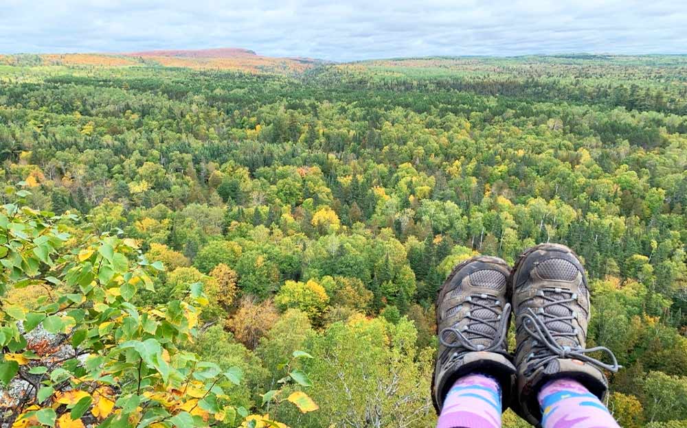
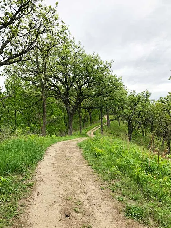
When you think of the Midwest, hiking may not be the first thing that comes to your mind. But those of us who live here know there’s plenty to see on a trail in the middle of the US! Some of the best hiking in the Midwest is where you’d least expect it.
Which is part of the fun of hiking, right?

This post may contain affiliate links. For more info, see my disclosures.
From underrated national parks with the most incredibly scenic views to waterfront trails, the Midwest truly has some beautiful spots worth visiting. Whether you live in the Midwest or are planning a visit, there are some pretty unbelievable sights. This guide shows you where to find them!
What better way to experience the wide open spaces of the middle of the USA than by hiking!
What states are in the Midwest?

Before we get started, let’s define which states are included in the Midwest:
- Iowa (IA)
- Illinois (IL)
- Indiana (IN)
- Kansas (KS)
- Ohio (OH)
- Michigan (MI)
- Minnesota (MN)
- Missouri (MO)
- Nebraska (NE)
- North Dakota (ND)
- South Dakota (SD)
- Wisconsin (WI)
And since I haven’t been everywhere (although it’s on my list!), I called in some fellow travel bloggers to help compile this list of the best hiking in the Midwest. From easy to difficult, distances of less than a mile to over 300 miles, this list has so many options to plan your next hiking destination!
By the way, if you want to pair a hike with a good Midwest road trip, here are 16 routes for you!
Save money on travel with points:
Check out the best credit card offers to save big money by using rewards points for flights and hotels. They’re so good; I regularly have 2-3 in my wallet and book most of my travel with points!
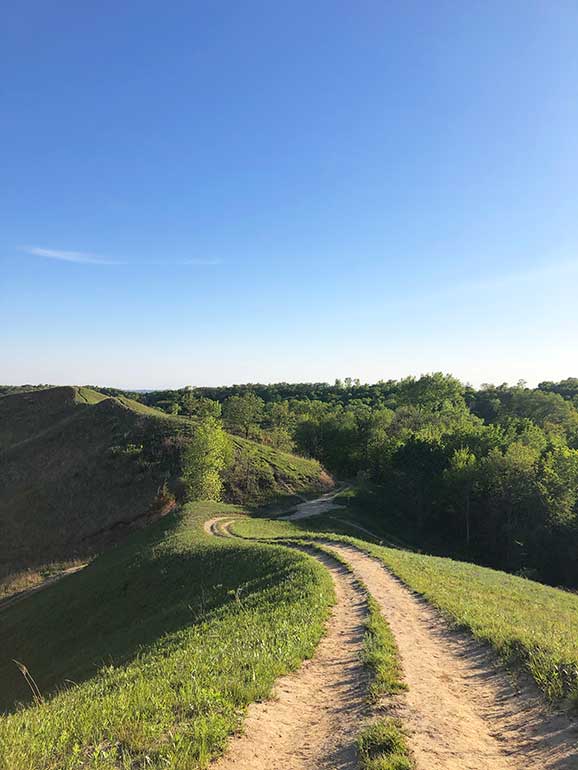
Best hiking in the Midwest
Midwest hiking adventures await! From rolling hills and lush forests to large lakes and unique land formations, there’s so much to explore. Here’s a guide to the best hiking in the Midwest – including at least one trail in every state!
Note: all trail distances below are round trip.
Let’s dive into the list!
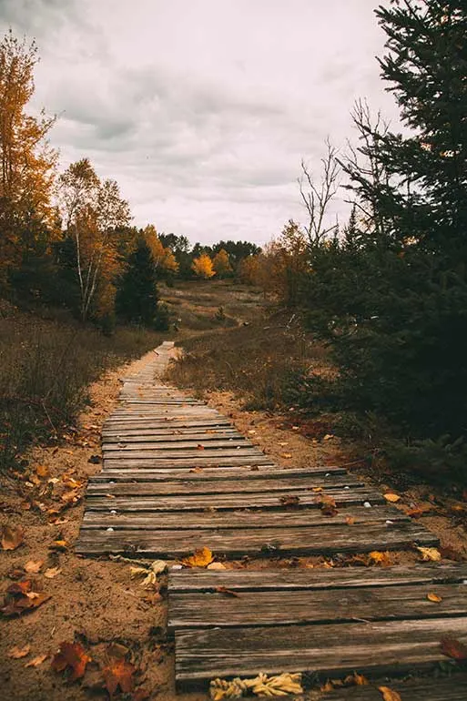
1. Red Trail, Whitefish Dunes State Park, Wisconsin

Hike distance: 1.2 miles
Hike time: up to 1 hour
Difficulty rating: easy
The Red Trail features spectacular lake views and begins at the Nature Center Park Office in Whitefish Dunes State Park in Door County, Wisconsin. The Red Trail itself is only about 1.2 miles long, but it is typically combined with the Yellow Trail for a 3.6-mile loop. The elevation gain is 72 feet and it is great for all levels of hikers. Just be sure to wear comfortable walking shoes.
Along the Red Trail, hikers also have the option to take a short hike to the Old Baldy observation platform for great views of Lake Michigan and Clark Lake. Old Baldy is the tallest dune in Whitefish Dunes State Park at 93 feet above sea level.
Once you complete the loop back to the Nature Center, you can also continue to the Black Trail to Cave Point County Park. The Black Trail is a loop and is about 2.1 miles.


Cave Point County Park is also beautiful, with breathtaking stone cliffs and many fun outdoor activities. This park also offers kayakers the opportunity to see dozens of underwater caverns that you cannot see from the hiking trail.
Whitefish Dunes State Park and its hiking trails are open all year long, and it’s always a beautiful place to hike or snowshoe/cross country ski! However, visiting in fall is arguably the best time to hike the Red and Yellow Trails. The fall colors are at their peak in mid-October and are magnificent. You can even rent a cabin in Door County that’s right on the border of Whitefish Dunes State Park!
Recommended by By Lindsey Puls of Have Clothes, Will Travel
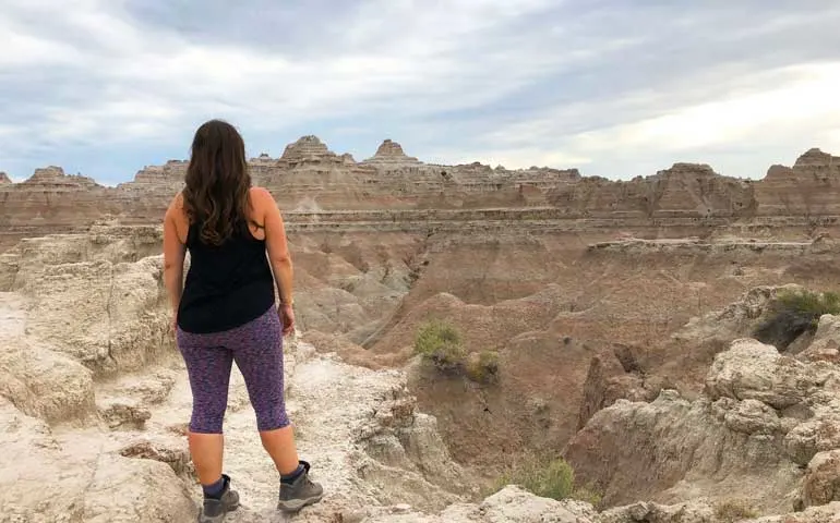
2. The Notch Trail, Badlands National Park, South Dakota

Hike distance: 1.3 miles
Hike time: up to 1 hour
Difficulty rating: moderate
Perhaps some of the best hiking in the Midwest is in South Dakota. In the southwest corner of the state, Badlands National Park is a unique landscape that just begs to be explored! With incredible spires, deep valleys and amazing views, this national park will blow you away.
One of the best hikes in Badlands National Park is The Notch Trail. A relatively short trail, it’s just 1.3 miles round trip. A fun feature of this hike is a wooden ladder you need to climb to reach the top, where you’ll find some of the best views in the park!
Other parts of The Notch Trail are steep and narrow, so be sure to have good hiking shoes with traction. Due to this, the best time of year to visit Badlands National Park is spring, summer or fall as hiking becomes slippery and difficult in the wintertime.
By the way, these are my favorite hiking boots for women. And here are my husband’s favorite hiking boots for men. We’ve worn them hiking throughout our worldly travels and cannot recommend them enough.
There’s plenty of other things to do in Badlands National Park, like driving The Loop, which is just 39 miles and includes 16 overlooks! The Yellow Mounds section of the park is really fun to explore as well.
One of my favorite parts of Badlands NP is that it’s an open-hike park, which means it’s all free to explore and you don’t need to stick to a trail. Just make sure to track where you’re at as the landscape can be very disorienting. In the summer, be especially careful by packing extra water as the summer weather is intense.
Recommended by me – Nikki of She Saves She Travels
Related read: what to pack for a day hike
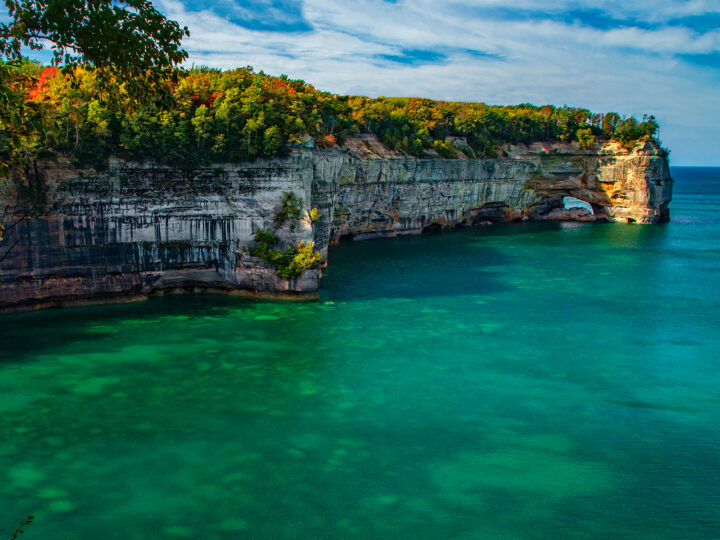
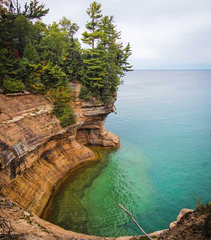
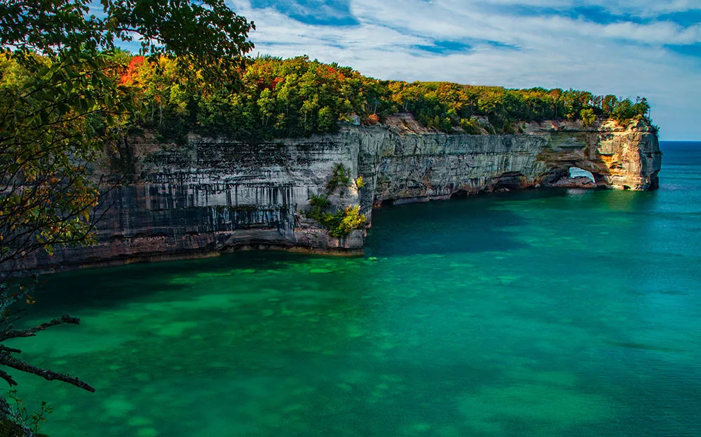
3. Chapel Loop Trail, Pictured Rocks National Lakeshore, Michigan

Hike distance: 10.2 miles
Hike time: 4 – 5 hours
Difficulty rating: moderate
The 10-mile Chapel Loop Trail in Michigan’s Upper Peninsula is the best way to experience Pictured Rocks National Lakeshore from land, easily making this one of the most picturesque hiking trails in the Midwest.
With about 750 feet of elevation gain, this moderately difficult trail will take you about 4-5 hours to complete. Most of the trail hugs the shores of Lake Superior and the Pictured Rocks, meaning there are plenty of beautiful lookouts along the way for rest stops!
Hike the Chapel Loop Trail during the warmer months between April and October for the best experience. Arrive early to get a parking spot at the trailhead, as it fills up very fast. Bring lots of water and snacks as there are no facilities once you enter the trail. Finally, it’s best to complete the loop clockwise to enjoy the flat part of the trail at the end of your hike when you’re tired!
After your hike, get your energy back by eating a pastry filled with meat and potatoes, one of the UP’s food staples! You should also spend a day on the water kayaking near the Pictured Rocks. The water is a bright blue and contrasts beautifully with the reds and oranges of the rocks.
Stay in nearby Munising or Au Train, which are full of cute rental cabins. These are often in wooded areas near smaller lakes where you can swim in the lakes during the day and roast s’mores by the fire at night. It’s the perfect weekend getaway!
Recommended by Jen of Glasses and Boarding Passes
By the way, if you need a rental car to explore all these awesome hiking trails, be sure to check out Discover Cars. I usually save 10%-30% on rental cars using this free service. They search the best deals from the top carriers and it’s a win-win. Search cheap rental cars now.
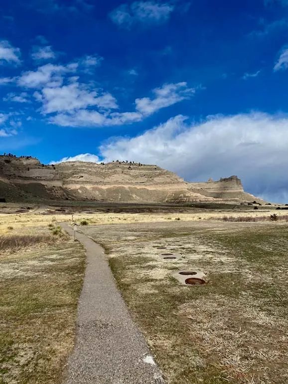
4. Saddle Rock Trail, Scotts Bluff, Nebraska

Hike distance: 3.0 miles
Hike time: 1 – 2 hours
Difficulty rating: easy/moderate
“Hiking” and “Nebraska” aren’t words that most people put together. But located in the state’s remote western frontier is a surprisingly scenic and fun hike – Saddle Rock Trail.
Saddle Rock Trail takes hikers to the summit of Scott’s Bluff, of Scott’s Bluff National Monument. For generations, the 800 foot monolith has served as an important landmark for Native Americans and westward pioneers. Today, it breaks up the monotony of endless prairie for Midwestern road trippers and proves that yes, epic hikes are in this part of the United States.
The trail starts out by meandering across the prairie before making its ascent up the bluff. In spring and summer, the prairie’s wide variety of wildflowers are in full bloom. At the midway point, there’s man-made rock tunnel that takes hikers to the other side of the bluff.
The rest of the hike is a series of gentle switchbacks before reaching the trail’s namesake – Saddle Rock. You can’t hike out to it, but you can take great pics of it from the trail. And just a little beyond that is the summit of the bluff itself. Because there’s nothing around to block the view, hikers are treated with amazing views of the surrounding land for the entire hike.
The trailhead is located beside the Scotts Bluff National Monument visitor center. Roundtrip is only 3 miles and total elevation gain is 564 feet.
Recommended by Maggie of Pink Caddy Travelogue
5. Superior Hiking Trail, Minnesota

Hike distance: small sections, total trail is 300 miles
Hike time: variable
Difficulty rating: depends on the section
Have you heard of the 300+ mile Superior Hiking Trail (SHT) in Minnesota? It stretches from the border of Canada to Wisconsin along the ridge that overlooks Lake Superior, some of the most pristine wilderness in the state. It’s definitely some of the best hiking in the Midwest!
If hiking 300 miles isn’t for you, don’t worry. The SHT is designed to be hiked in sections, some of which are just a couple of miles. It’s a true build-your-own-adventure trail that’s perfect for hikers of all skill levels.
Because the trail is split into sections, there are dozens of trailheads to choose from. Some of the most popular sections are in Jay Cooke State Park near Duluth and along Highway 61 on the north shore of Lake Superior.
Grand Marais is an adorable harbor town that offers access to the northernmost sections of the trail, including lots of waterfalls. Get a glimpse of Canada from High Falls in Grand Portage State Park, grab coffee at Java Moose, wander out to Artist Point, and end your day with a bite from Angry Trout.
The trail is open year-round, but can be difficult to navigate in winter (November-March). From March to May, expect the trail to be muddy. June through October are the most popular times to hike the SHT. Try hiking in mid-week to avoid crowds!
Although you might assume Minnesota is flat, the trail gains more than 42,000 feet of elevation over the 300+ miles! Expect a lot of up and down. Hikers should consider bringing trekking poles, plenty of water and mosquito repellent.
Recommended by Susan of This Big Wild World
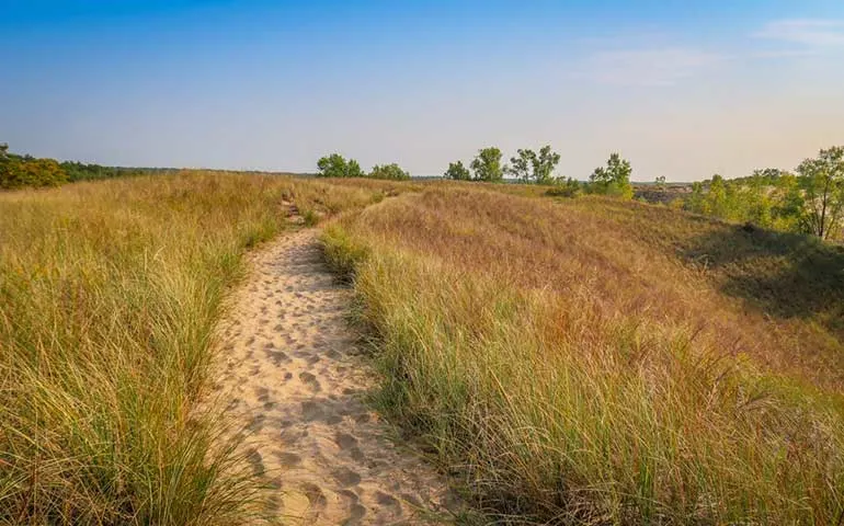
6. Trail 9, Lake Michigan and Indiana Dunes State Park, Indiana

Hike distance: 3.8 miles
Hike time: 1.5 – 2 hours
Difficulty rating: moderate
Hiking along Lake Michigan’s sand dunes is a must-do activity for visitors to this spectacular Great Lake. And there is no better place to wander among the dunes than at Indiana Dunes State and National Parks. Located only an hour’s drive from Chicago, Indiana Dunes comprises 15 miles of stunning shoreline and fabulous sandy beaches.
While there are miles of trails to choose from, Trail 9 should be on everyone’s Indiana Dunes itinerary. Even though the name is rather uninspiring, Trail 9 provides some of the best representative views of the park’s sand dunes.
This 3.8-mile loop traverses both mature forests and sandy dunes while also affording incredible views of Lake Michigan. Hikers can see all the way to Chicago on a clear day. This is some of the best hiking in the Midwest based on the views!
With 232 feet of elevation gain, Trail 9 is a relatively easy trek that can be attempted by hikers of most skill levels. However, hiking on sand dunes is more tiring than on other trails! Be sure to bring sturdy footwear as well as a lightweight towel and swimwear if you’d like to take a dip in the lake.
Summer is the most popular time to visit Indiana Dunes due to Lake Michigan’s warm weather. Avoid the crowds by visiting in the spring or fall – or bring snowshoes and come in the winter months. Other popular activities at Indiana Dunes include biking, beach walking and bird watching.
Recommended by Katy of A Rambling Unicorn
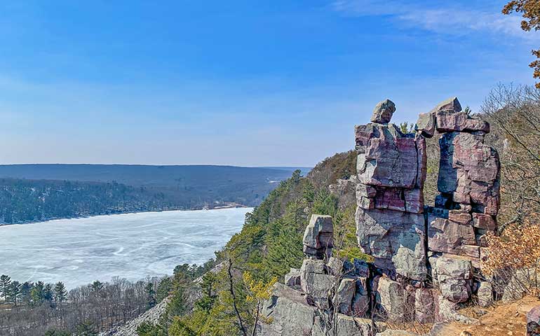
7. Devil’s Lake Loop Trail, Baraboo, Wisconsin

- Hike distance: 5.1 miles
- Hike time: 2 – 3 hours
- Difficulty rating: moderate
One of the best hikes in the Midwest is the loop trail that encircles the uniquely scenic Devil’s Lake. Located just on the outskirts of Baraboo, Wisconsin, this hiking trail is diverse, has striking viewpoints and has incredible remnants of the impact of the Ice Age on the Midwest.
The main loop around Devil’s Lake is a mixture of 3 different trails and gains over 1,000 feet in elevation. Leave the Visitor Information Center to start on East Bluff Trail and savor the views from the Devil’s Doorway. To get down the hill, take the Balanced Rock Trail and don’t miss the peculiar rock that sits propped up on the bluff-side.
The trail twists through large accumulations of Baraboo’s Quartzite, which range from hues of pinks and purples from the iron deposits. Stroll along the lake and connect with the lower Tumbled Rocks Trail, which cuts through more large collections of stones.
Devil’s Lake is open all year; however, the trails are not maintained during the winter. It’s best to visit in the spring, fall, and summer, but snowshoer’s will appreciate quiet trails during the winter months. In a day pack, include water, snacks, and a picnic. Make sure to wear good supportive hiking shoes and maybe hiking poles for the steeper sections of the trail.
Baraboo is small, but close to a wide range of hiking, biking and kayaking options. In fact, Devil’s Lake State Park is in the 1,000 mile Ice Age National Scenic Trail. In Baraboo find wineries, distilleries and the Circus Museum. The bustling capital city of Madison is less than an hour away.
Recommended by Megan of Packing up the Pieces
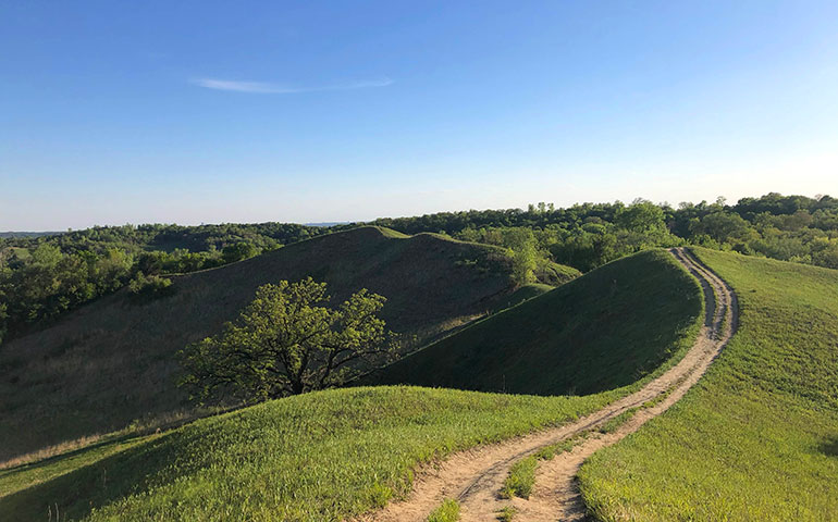
8. Badger Ridge Trail Loop, Hitchcock Nature Center, Loess Hills, Iowa

- Hike distance: 3.1 miles
- Hike time: 1 – 2 hours
- Difficulty rating: easy/moderate
Perhaps some of the best hiking in the Midwest is in the Loess Hills. A unique land formation, the Loess Hills stretch over 200 miles along the Missouri River, from eastern South Dakota through western Iowa, eastern Nebraska and western Missouri.
Fun fact: the Loess Hills in the Midwest is actually made up of loess silt. The only other land formation similar on the planet is located in Shaanxi, China. Read more about this unique typography here.
Some of the best hiking in the Midwest is the Loess Hills is in Hitchcock Nature Center in Iowa. Located just 20 minutes northeast of Council Bluffs, Iowa and Omaha, Nebraska. It’s a perfect spot for a day trip from the cities or there are even camp sites in the nature center.


Hitchcock Nature Center has over a dozen interconnected trails. The hiking trail with the most scenic views is the Badger Ridge Trail Loop. It’s 3.1 miles with an elevation gain of 501 feet, rated as a moderate hike. The trailhead is located at the parking lot nearest to the visitor center.
At various points on the trail you’ll see rolling hills, flat plains and even the Omaha skyline. Be sure to protect your clothes with tick repellent before you go, and use a thick layer of bug spray especially if hiking during dawn or dusk.
The best time of year to hike the Hitchcock Nature Center is spring and summer. By fall the vegetation is overgrown and difficult for hiking and in the winter the trails can be covered in snow drifts. For additional hiking in the area, consider the Heron Haven Nature Center, Fontenelle Forest and the Platte River State Park.
Nearby in Omaha there’s plenty to do for visitors. The Omaha Henry Doorly Zoo and Aquarium is constantly ranked in the top 5 zoos in the USA. Check out the Old Market for shops and dining, plus some of the most Instagrammable spots in Omaha. Visit museums, go zip lining and walk the pedestrian bridge that connects Iowa and Nebraska over the Missouri River.
Recommended by me – Nikki of She Saves She Travels
Best hiking in the Midwest – more trails
This is the midway point in this list of the best places to hike in the Midwest. Have you picked your next hiking destination yet? If not, let’s keep going!
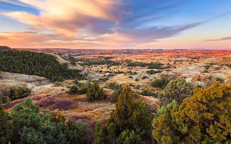
9. Caprock Coulee Loop Trail, Theodore Roosevelt National Park, North Dakota

- Hike distance: 4.4 miles
- Hike time: 2 – 3 hours
- Difficulty rating: moderate
Perhaps one of the most remote hiking trails in the Midwest is in Theodore Roosevelt National Park in western North Dakota. With amazing scenery and not much for crowds, this is one of the most underrated national parks in the US!
Located in the North Unit of Theodore Roosevelt National Park, at 4.4 miles and an elevation gain of over 500 feet, the Caprock Coulee Loop Trial is a moderate hike. With tremendous views throughout the hike and the frequent wildlife sightings on the trail, this is one of the best hikes within the park!
The best time to hike this trail is spring to fall, as the North Dakota winters are brutal. Because spring is calving season for bison, be especially careful on the trail if you choose to hike in the spring. Bison are often sighted on this trail, which is fun if it’s from a distance!
Be sure to wear sunblock as there’s very limited shade on the Caprock Coulee Loop Trail. Take plenty of water and bug spray, too! Hiking poles are also useful for this trail. With limited services throughout the park, use restrooms at the visitor centers and pack heavy snacks or food in a cooler for the day.
While visiting the national park, be sure to explore the 14-mile scenic drive in in the North Unit and the 36 mile drive in the South Unit. Theodore Roosevelt National Park is located near Medora, North Dakota. Since it’s not a huge tourist destination, accommodations are limited. Alternatively, if you’re taking an RV or prefer camping, there’s plenty of options in the area.
Recommended by me – Nikki of She Saves She Travels
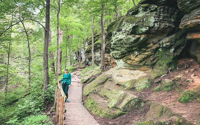
10. The Ledges Trail, Cuyahoga Valley National Park, Ohio

- Hike distance: 2.2 miles
- Hike time: 1.5 – 2 hours
- Difficulty rating: moderate
The Ledges Trail is the perfect hike for anyone living in or visiting the Midwest because it delivers a big reward for moderate effort. This loop is 2.2 miles long, takes about 1.5 hours to do, and the elevation change is around 80 feet. The trailhead is located on Kendall Park Road in Cuyahoga Valley National Park, about 40 minutes south of downtown Cleveland.
The Ledges Trail is perfect for those seeking light adventure, without requiring a high fitness level or tons of hiking experience. Pass huge slabs of rock with shades of green, brown and orange rippling through them. They are breathtaking to look at, fun to climb and extremely photogenic.
Hiking the Ledges Trail is best in spring and fall, as summer in Ohio is hot and humid and winter causes unsafe conditions. The Ledges Trail is well-shaded so you probably won’t get sunburnt, but you may still want to bring a hat and wear sunscreen as a precaution. Be sure to also bring bug spray and wear clothes that cover your arms in legs to further protect yourself from insects.
As this hike is located in Cuyahoga Valley National Park, there are a myriad of other trails in the area to check out. However, if you’re tired of hiking, downtown Cleveland, Ohio is 40 minutes away, and has plenty to do and lots of great restaurants.
First, visit the Rock and Roll Hall of Fame, before checking out Lake Erie at the E 9th Pier. Don’t forget to take a photo by the script Cleveland sign. For dining, Cleveland’s E 4th Street has great food stops, such as Mabel’s BBQ and Barrio right around the corner.
Recommended by Theresa of Fueled By Wanderlust
11. Black Elk Peak Loop, Custer State Park, South Dakota

- Hike distance: 7.1 miles
- Hike time: 3 – 4 hours
- Difficulty rating: moderate
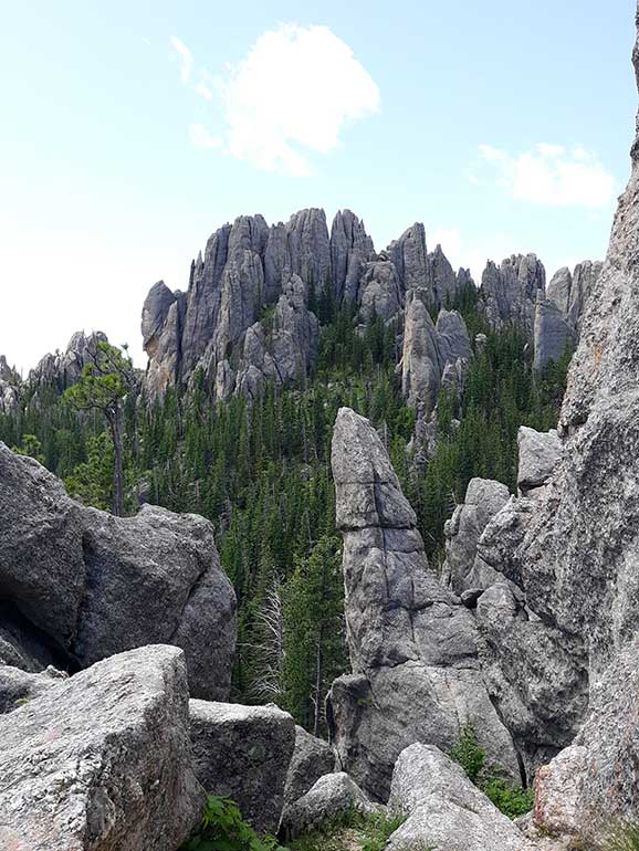
The hike up Black Elk Peak, in South Dakota’s Custer State Park, not only overlooks some of the most majestic views of the spire filled Black Hills region, but it is also the hike to the state high point of South Dakota! If you’re looking for the best hiking in the Midwest, this is it!
This day hike contains a moderate 7.1 miles roundtrip of gentle incline, dappled forests, enormous jutting spires and a historic stone fire tower that sits atop the granite summit of Black Elk Peak. At the top you’ll see impressive panoramic views from the roof of South Dakota at 7,242 feet high!
The elevation gain on this trail is 1,469 feet, and the trailhead is located in Custer State Park, immediately adjacent to Sylvan Lake. The nearest city is Rapid City, South Dakota. Hike Black Elk Peak year round, but the weather is most enjoyable in summer. There is a $20 entrance fee to hike inside Custer State Park.
Not only is this an invigorating hike in and of itself, but it is in close proximity to other outstanding outdoor gems!
Custer State Park is teeming with other hiking opportunities, pristine lakes and superb wildlife watching. Also nearby are the twin South Dakota National Parks of Wind Cave National Park and Badlands National Park and neighboring landmarks Mount Rushmore and Crazy Horse!
Recommended by Kristen of Yonderlust Ramblings
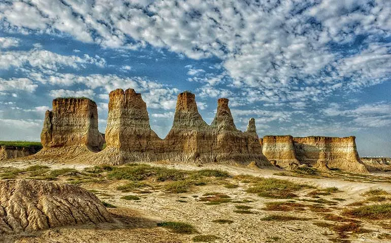
12. Trail at Monument Rocks Chalk Pyramids, Western Kansas

- Hike distance: .9 miles
- Hike time: up to 1 hour
- Difficulty rating: easy
A short jaunt from I-70 through western Kansas is this incredible geological formation. Also known as the “Pyramids of the Plains” it’s estimated these chalk rocks formed around 80 million years ago when the plains were covered by water.
The trail around the Monument Rocks is just under 1 mile and with only a 16 foot elevation incline, it’s possible for nearly everyone to experience this area.
Driving through the plains along I-70 is relatively flat, then something like these unexpected monument rocks appear out of almost nowhere! It’s a fun visit in the state any time of year. Just beware that with recent rains, the dirt road can be muddy and difficult to drive in and out of the area.
As you’re walking the trail, watch for snakes. And be sure to bring sun protection if visiting in the summertime as there’s no shade out here, beyond what the monument provides.
Monument Rocks Chalk Pyramids are located about half way between Oakley and Scott City, Kansas. You can also visit the nearby Castle Rock, which is a similar geologic formation nearby. To reach Castle Rock you must drive a 14-mile dirt road that’s not maintained, making it only passable on dry days.
Continue on I-70 west to Denver and start a Colorado Road Trip full of mountain adventures.
Recommended by me – Nikki of She Saves She Travels
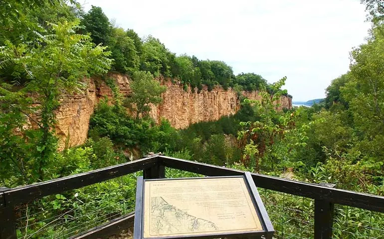
13. Horseshoe Bluff Trail, Mines of Spain, Dubuque, Iowa

- Hike distance: .86 miles
- Hike time: up to 1 hour
- Difficulty rating: easy/moderate
A great hiking trail in the Midwest is the Horseshoe Bluff trail at the Mines of Spain Recreational Area in Dubuque, Iowa. The trail is fairly short at 0.86 miles and has an elevation gain of 118 feet. It’s rated as a moderate hike.
Turning left from the parking lot, the trail immediately starts with a gravel incline. Once at the top, it offers amazing views over the bluffs of a canyon with the Mississippi River in the background. A metal staircase leads the way to the canyon floor where the bluffs then tower up on either side of the trail.
The second part of the hike is flatter and winds through a wetlands area where various animal species and birds sightings are common. The Horseshoe Bluff trail is a looped circuit and finishes back at the original starting point in the parking lot. The Mines of Spain Recreational Area is open year round, however this trail is best between spring and fall due to snow and ice forming on the metal staircase.
While in the area, there are plenty of things to do in Dubuque. Crystal Lake Caves are just 5 minutes away and have guided tours of an underground cave system. Downtown Dubuque is a 10 minute drive and has fun attractions such as the National Mississippi River Museum and Aquarium and the Fenelon Place Elevator.
Recommended by Kylie from Between England and Iowa
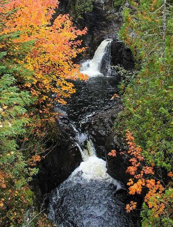
14. Cascade Falls Trail, Cascade River State Park, Minnesota

- Hike distance: 1.1 miles
- Hike time: up to 1 hour
- Difficulty rating: easy
When it comes to scenic hiking, Minnesota is often overlooked. Yet, the northern trails along Minnesota’s North Shore, especially during the fall, cannot be beaten! A hiking trail that deserves all the hype from nature enthusiasts and waterfall searchers is the Cascade Falls trail in Cascade River State Park.
This hiking trail is the most popular in the park, which means the trailhead can be crowded on picturesque, sunny days. The trailhead is located directly off the main road, Highway 61, making it impossible to miss. To avoid crowds, visit the trailhead early.
This easy hike is 1.1 miles and has an elevation gain of 209 feet, making it a great trail for all levels of hikers. During autumn, visitors will hike through the dense Minnesota forests and experience the rainbow hues of foliage up close. The Cascade Falls are easy to reach and are perfectly framed by the fall foliage, making it a photographer’s dream to visit.
If you are looking to explore hiking trails that are more off-the-beaten-path, the Lookout Mountain Loop is nearby and offers quieter scenery. This area offers some of the best hiking in the Midwest!
After hiking, head to the nearby town of Grand Marais where you can enjoy some local brews and grub at Voyageur Brewing. Grand Marais also has a picturesque boardwalk that is great for a short stroll.
Visitors can make their way out to the harbor’s lighthouse for an intimate view of the waterfront city. Don’t forget to grab a savory souvenir of some smoked fish at the Dockside Fish Market before you leave.
Recommended by Martha of Quirky Globetrotter
15. Giant City Nature Trail, Shawnee National Forest, Illinois

- Hike distance: 1.0 miles
- Hike time: up to 1 hour
- Difficulty rating: easy
Giant City Nature Trail beckons hikers to wander through a world of lofty, moss-kissed rock formations inside Illinois’ Giant City State Park. While rocky in spots, the 1-mile loop trail is fairly easy to hike overall welcoming hikers of all levels.
Elevation gained during this favorite Shawnee National Forest hike is 160 ft. The trail treats to views of distinctive rock formations displaying intricate layering, pointy edges and honeycomb structures.
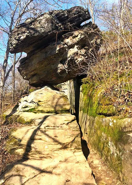
Hikers marvel walking through the alleys of “Giant City” bordered by impressively tall stone walls. Continuing the trail, hikers enter a little cave and emerge on the other side right underneath a several ton Balanced Rock just balancing right overhead!
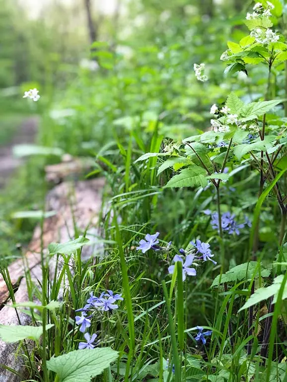
A variety of footpaths spin off of the main trail allowing for additional glimpses of formations. When there is sufficient rain, dripping water adds another element of interest. In spring, wildflowers spread more beauty. Bold autumn colors make fall another favorite time to visit.
Giant City State Park is located closest to Makanda, Illinois and about 8 miles from Carbondale. A trip to Giant City State Park can easily be paired with a visit to Pomona Natural Bridge which can be viewed from a 0.3-mile loop trail.
Southern Illinois also has quite a collection of wineries to sip and swirl at including Blue Sky Vineyard and Feather Hills Vineyard and Winery in Makanda. In Carbondale, museum lovers may enjoy a visit to the Old Illinois Passenger Depot Railroad Museum, The Science Center of Southern Illinois or African American Museum of Southern Illinois.
Recommended by Melissa of A Little Time and a Keyboard
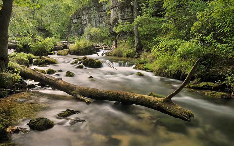
16. Greer Spring Trail, Mark Twain National Forest, Missouri
- Hike distance: 1.4 miles
- Hike time: 1 hour
- Difficulty rating: moderate
Located in southeastern Missouri, Mark Twain National Forest has a lot to offer visitors. Johnson’s Shut-Ins State Park, Elephant Rocks State Park, Talking Rocks Cavern, Taum Sauk Mountain State Park and so much more.
A lesser-known area within the Mark Twain National Forest is on the southwestern side of the forest, near the small town of Alton, Missouri. The powerful Greer Spring pushes about 220 million gallons of water a day, so it’s not just a tiny stream – more like a powerful water source that’s created it’s own flora/fauna ecosystem.
The Greer Spring Trail down to the stream and falls is about 1.5 miles round trip, with just over 200 feet in elevation gain. The terrain is steep at some parts and can be slippery with recent rains. Good hiking shoes with traction are highly recommended. This is undoubtedly one of the most perfect – and best hiking in the Midwest.
Stick to the trail closely as poison oak and poison ivy are prevalent in the area. Treat your clothing with tick prevention and wear bug spray as well. Due to this area being overgrown and uncomfortable in late summer, the best times to hike the Greer Spring Trail are fall, winter and spring.
Recommended by me – Nikki of She Saves She Travels
Best hikes in the Midwest – 16 cool hiking trails

Well, there you have it! The top trails in the middle of the US. From the rolling hills in Iowa to the Great Lakes of Wisconsin and the National Parks in the Dakotas – this list has a little bit of everything!
Let’s recap in a more condensed format…
Best hiking in Midwest:
- Red Trail, Whitefish Dunes State Park, Wisconsin
- The Notch Trail, Badlands National Park, South Dakota
- Chapel Loop Trail, Pictured Rocks National Lakeshore, Michigan
- Saddle Rock Trail, Scotts Bluff, Nebraska
- Superior Hiking Trail, Minnesota
- Trail 9, Lake Michigan and Indiana Dunes State Park, Indiana
- Devil’s Lake Loop Trail, Baraboo, Wisconsin
- Badger Ridge Trail Loop, Hitchcock Nature Center, Loess Hills, Iowa
- Caprock Coulee Loop Trail, Theodore Roosevelt National Park, North Dakota
- The Ledges Trail, Cuyahoga Valley National Park, Ohio
- Black Elk Peak, Custer State Park, South Dakota
- Trail at Monument Rocks Chalk Pyramids, Western Kansas
- Horseshoe Bluff Trail, Mines of Spain, Dubuque, Iowa
- Cascade Falls Trail, Cascade River State Park, Minnesota
- Giant City Nature Trail, Shawnee National Forest, Illinois
- Greer Spring Trail, Mark Twain National Forest, Missouri
Have you picked out your next Midwest hiking destination yet? Comment below with your choice!
Related content to check out next:
16 Best Midwest Road Trips – Scenic Routes You Can’t Miss
30 Hiking Trails for Beginners: Top USA Hikes that are Actually Easy
28 Absolutely Best National Parks to Visit in Summer
Packing for a Day Hike: 20+ Things Not to Forget
101 Road Trip Food Ideas: Best Fun and Healthy Snacks You’ll Love
Find this post helpful? Save it for later or share it on social media!

OXT
Saturday 25th of March 2023
As a Nebraska expert I can say with out a doubt that the pine ridge escarpment has the best hiking in Nebraska. In this region you can visit Fort Robinson SP, Chadron SP, Soldier creek wilderness, Nebraska national forest-pine ridge district,etc…. Close to this escarpment Oglala National grassland holds toadstool geologic park, it’s like a mini badlands NP in Nebraska. In the world of fossils agate fossil beds NM offers a look into the past. Another great nature location in the Cornhusker state is the Niobrara river, its a national scenic river annd offers great kayaking. The niobrara river is a meeting point of floral species. The niobrar river has pines from the west, deciduous trees from the east, and boreal trees from the north.On the Niobrara you can see Nebraskas tallest waterfall, Smith falls. There are over 250+ spring fed waterfalls that flow year around. Some noteworthy waterfalls include: Fort falls, staircase falls, and snake river falls. This river also has many clear cold water streams that break off from the main body of water. Long pine creek is one of my favorite for tubing down in summer. Other noteworthy locations in Nebraska include the Sandhills. This is the largest sand dune formation in the western hemisphere covering 1/4 of the state or the same size as West Virginia. These sand dunes are stabilized by grass and start as small dimples in the east to 200-400ft tall dunes in the west. They best way to see them is to float down the dismal and North/south loup rivers. Another cool spot in the Sandhills is Merritt reservoir. Merritt is an international dark sky park that offers brottle class 1. Located in the middle of the Sandhills has some of the darkest skies around(use a light pollution app). The Sandhills is the one of the largest untouched prairies in the world. With millions of acres of wetlands the Sandhills has good fishing. Public land in the Sandhills is very limited and secluded to the Nebraska national forest-Halsey district and the Samuel Mckleive national forest and grassland. Highway 2 or any of the backroads can also showcase the sandhills. In the same region as Scottsbluff you will find many public acres. Such as Wildcat hills recreation area and many wildlife management areas that surround it. In this same region you can see the famous chimney rock and Court and jailhouse rocks on the Oregon trail. Next to this escarpment there is a cool lake that has white sand beaches. This lake is known as Lake Mccoungy. It is a 55^2 mil reservoir . The canyons on the south side also hold a important place on the Oregon trail known as Windlass hill. This hill is inside of Ash hollow SP. On the eastern side of Nebraska we have Lewis and Clark lake. This lake has cliffs on the edges and is really pretty. This lake sits right next to the Missouri national recreation river shared with South Dakota. On the Missouri River Nebraska has 2 SP, Ponca and Indian cave. Near Omaha the platte river holds three state parks, platte river, Mahoney, and schram. If your ever in Nebraska in March you have to see the Sandhill crane migration. Over 600,000 birds or 80% of the worlds population land on the platte river and stay for a couple weeks to recharge to head to their breeding grounds in the north. When driving along 1-80 many people believe Nebraska is completely flat, little do they know that Nebraska is one of the least flat Midwest states. Nebraska has so much hidden gems that deserve respect. Many Midwest states have a superiority complex over Nebraska because they have only seen the river plain on 1-80. But I bet if people see the Sandhills or any escarpment they will have second thoughts. The biggest problem with Nebraska is they are one of the most privately owned states. Public land is limited and spread out. Give the Cornhusker state a try:)
Nikki
Thursday 30th of March 2023
Wow thank you so much for such a comprehensive comment on the fun spots in Nebraska! As a fellow Nebraskan, I've been to many of the places you've described, but not all of them. I agree Nebraska - and most of the Midwest - is incredibly underrated!
Steve
Monday 29th of August 2022
Porcupine Mountain Wilderness is a great place to hike. Beautiful Lake Superior campsites and views, high ridge campsites with views of forest tops and Lake of the Clouds, and campsites in the wilderness.
Nikki
Tuesday 30th of August 2022
Ah, thanks so much for your suggestion Steve! Sounds like I need to make a trip there to see it myself (and add it to the list officially too) :)
Julie Moore
Friday 25th of February 2022
Can't believe Hocking Hills Ohio didn't make this list. Any of the many trails there are stunning with impressive rock formations and waterfalls.
Nikki
Sunday 27th of February 2022
Great suggestion Julie! I personally haven't been there and neither have the guest writers, either. Glad to hear Hocking Hills has such great hiking.💛
David
Sunday 29th of August 2021
We have been to each of these locations and our favorite is by far the Shawnee National Forest, so much to see and do, it is unbelievable.
Nikki
Monday 30th of August 2021
Very cool, David! That's so awesome you've been to all of them. Shawnee National Forest has so much to offer, I'm glad to hear it's your favorite. :)
Ashlee Fechino
Sunday 30th of May 2021
What an excellent list. I was so surprised by how clear the water is at Pictured Rocks National Lakeshore!
Nikki
Monday 31st of May 2021
Yes Ashlee, it's beautiful! Thanks for visiting the blog today :)